Click on the "HD" button in the right corner (so it's red) to watch in high definition.
I'm still experimenting with recording the approach of storms over a lengthy period of time here in Central Florida. On Saturday, the sun hung on for much of the afternoon, allowing the heat to make for a heightened chance of a good thunderstorm.
When the sky was still somewhat blue, I set up my video camera on my front porch and pointed it westward above the apartment buildings across the parking lot. We're been locked in a pattern in which the Gulf Coast sea breeze has been more dominant, pushing all of the storms toward the east coast of the peninsula, where I'm located. The collision of the breezes from the Atlantic Ocean and the Gulf of Mexico is what makes Florida so stormy during the summer. I just had to hope for a thunderstorm to form, then move overhead.
Like a broken record, though, the weather did produce yet another afternoon thunderstorm. The National Weather Service warned that it would be severe.
The total length of the recording is about 75 minutes, but I have condensed it into 55 seconds. It's interesting to see the sun occasionally break through the clouds. Then, toward the end, a huge cumulonimbus storm top billows upward and outward. Unfortunately, that is when I had to change tapes, so there's a quick jump as the top of the storm builds.
At the end, the underside of the storm moves rapidly as the rain pours in sideways, which is when I had to cut the recording short.

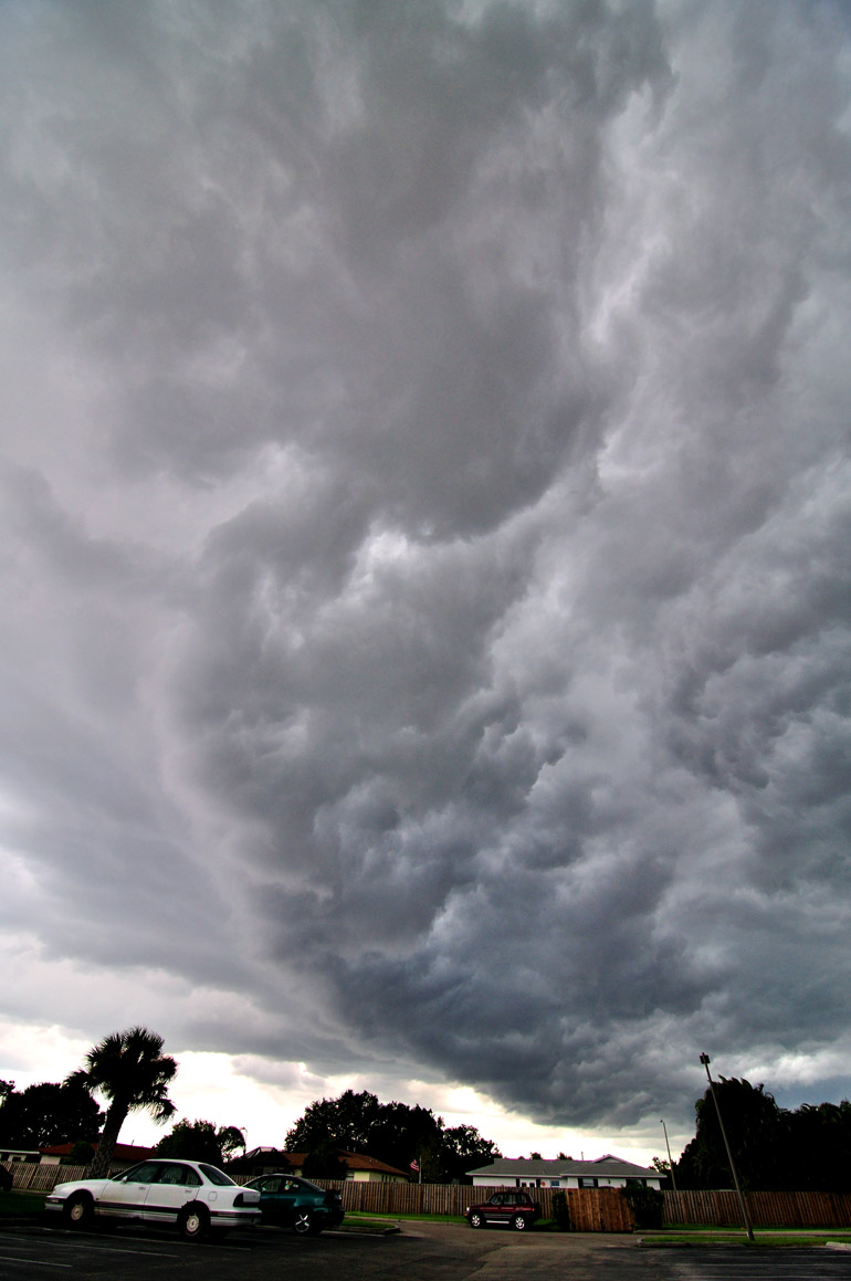
Unless viewed in such a time-lapse video as the one at the top, the storm wasn't incredibly visibly impressive. There was some lightning, but it was of the low-frequency variety. Here is a photographic view looking south, where I think the storm was more severe.


2 comments:
I was watching the Stormchasers marathon on Discovery this weekend and was thinking you'd be right at home there.
Maybe some day.
Post a Comment